Urban Intelligent Software

Urban software is a state of the art innovative software platform, integrating best-of-breed C4I Applications for Intelligence agencies, Police departments and Crisis Management organizations, enabling them to get intelligence information from raw video and other sources..
Urban Intelligent Software Overview
- An open, secure, redundant and scalable system which captures, records and manages video from various sources
- Smart, real-time content analysis
- Innovative C4I functions by utilizing 3D GIS maps
- Built-in integration with MM & ISPE
- On-line/Off-line video investigation tools
- Long-term video archiving management
- Integrates with emergency organizations systems
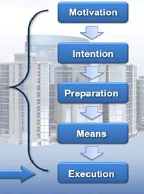
21st century security is an active security system targeting the entire attack process.
20th century security is a Passive security system dealing with the Execution phase only.
Operational Concept
- Coverage of sites potentially related to terrorist or criminal activities
- Customized Areal Coverage based on threat analysis
- Detection and alert generation of suspicious objects and activities
- Operational procedures for controlling dispatched forces
- Alert driven surveillance and tracking abilities
Operational Modes
- UrbanShieldSensors routine mode:
- Automatic sensors control of coverage area
- Early detection and alert regarding every suspicious activity
- Full Real-Time support for operational dispatched teams
- Crisis Management System support
- UrbanShieldISPE targeted mode:
- Conducted by MasterMind’sintelligence knowledge
- Provides MasterMindwith targets detections
System Components
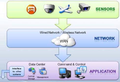
Urban Shield Components
- Command & Control
- Video Surveillance
- License Plate Recognition (LPR)
- Face Capturing (FC) & Face Recognition (FR)
- Support of Wireless and Wire-line Networks
- Core Infrastructures
- Integration with Intelligence and other systems
Command & Control
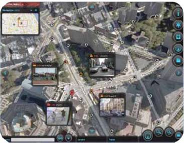
- 3D GIS Presentation Layer
- Display of integrated, accurate and up to date “Situation Picture”
- Event Correlation and Management
- Decision Support functions
- Force Dispatching mechanism
- Planning, Simulation & Training Modes
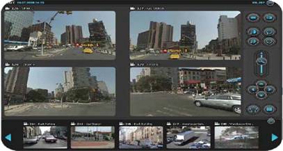
Video Surveillance
- Capturing and Recording of High Quality Video from variety of sensors, including from UAV’s and Satellites
- Effective video management
- Adaptive, Real-time Content Analysis
- On-line/Off-line Video Investigations
- Long-term Video Archiving Management
License Plate Recognition (1)
- Day and Night (Low light) License Plate Detection
- Multiple Black-lists or Traffic Monitor Modes of operation
- Local and Central Management
- Real Time and Investigation capabilities
License Plate Recognition (2)
- Support of Ground, pole and Gantry Installations
- Lane and Between Lanes Coverage
- High Speeds car detections
- Communication failures fault tolerance
- Generation of Plate and Car overhead pictures
Face Capturing & Recognition
- Supported by designated specialized high resolution cameras
- On pole pre-processing encoders
- On-line, Indoor/Outdoor Face Capturing from Live Video Feeds
- Best portrait algorithm
- Central Face Album Database
- Various Investigation features
Wireless and Wire-line Networks
- Support of combined WiMAX and MPLS networks
- Effective and secured video transportation
- Scalable network
- Complete network monitor and control
System Interfaces
Interface With MasterMind
Real Time Interface between UrbanShield And MasterMind
- From MasterMind:
- Priority Intelligence Request (PIR)
- License Plate Black List load and Update
- Sensor Status Report
- Sensor Configuration request
- From UrbanShield:
- Detections
- Intelligence Reports
- Raw Sensor Data
- System status
Interface with ISPE & CDR-INT
- Suspect location based on cellular triangulation
- Data correlation between different data sources to increase intelligence information reliability
- Link analysis over UrbanShield and other sources metadata
Integration With Emergency Organizations
- Police Department DB’s & Systems
- Intelligence & Security Services
- Hospitals and Emergency Evacuation Organizations
- Firefighters
- Weather & Seismic Forecast Centers
- Ministry of Interior and Municipalities
Command and Control Room
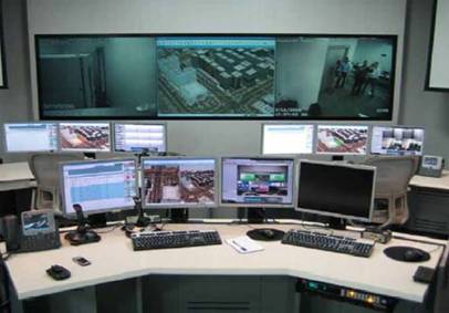
Operator’s Workstation
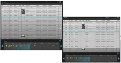
Video Application
3D GIS Application
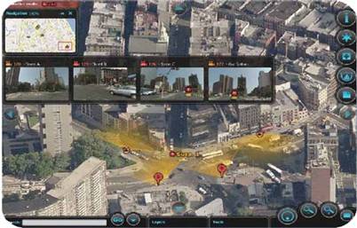
Event Management
