TMP-CCS C4i - Sistema di Comando e Controllo di Attacco Tattico
- TMP-CCS è un avanzato sistema di Conoscenza Situazionale sviluppato per l’uso militare.
- Pianifica e dirama ordini e comanda le unità, dal fronte.
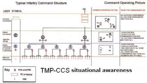
- Per i comandanti di plotone è possible ora pianificare e scaricare istantaneamente ordini elettronici per le sezioni contrassegnate con mappatura, per la prima volta i comandanti sono sempre a conoscenza della precisa collocazione delle sottounità.
- Il puntuale controllo e posizionamento aumenta di conseguenza l’efficacia dell’operazione.
- I comandanti possono vedere quando le posizioni pre-pianificate sono raggiunte.
- Monitora la posizione di ciascun soldato durante l’operazione, evidenziando discostamenti dal piano originario.
- TMP-CCS può identificare e tracciare la posizione di ogni soldato, veicolo o oggetto mentre si muovono attraverso lo spazio di battaglia, ogniuno con il proprio simbolo, segno distintivo e tipo di arma.
- Un aggiornamento in tempo reale della posizione (ogni 2 secondi) può essere sovrapposto al piano.
- Il trasferimento dei dati del TMP-CCS può essere crittografato come richiesto.
OVERVIEW
Operations – Situational Awareness
- All deployed operatives know where they are, the exact location of their team members and other units.
- This information is also automatically shared with other deployed forces.
- Ensures all sub units and individuals are in pre planned positions before crossing the start line.

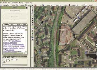
- Operational plans are overlaid on geo referenced mapping (Satellite, Image, Raster, Vector etc.)
- Plans are electronically shared with others
- Quick adaptation to and communication of amended plans
- Review the movement and deployment of all personnel
- Improved training
Control
- TMP-CCS is an advanced Situational Awareness system developed for military use.

- Plan and issue orders and control your units, from the front line.
- Platoon commanders can now plan and instantly download electronic orders to marked with mapping sections, for the fi rst time commanders always know the precise location of sub units.
- Precise control and positioning results in increased battle effectiveness.
- Commanders can see when pre-planned positions are attained.
- Monitors positions during the operation, highlighting variance from the original plan.
- TMP-CCS will identify and plot the position of every soldier, vehicle, or object as they move through the battle space, each with their own symbol, call sign and weapon type.
- Real time position updates (every 2 seconds) can be overlaid onto the plan.
- TMP-CCS data transfer can be encrypted as required.
- Fire missions are automatically generated simply by identifying the enemy target and dragging icon images onto the map on the screen.

- The geo-referenced mapping in TMP-CCS C4i is always active, making it possible to incorporate a Fire Mission platform for control of local fi re support teams.
- Each fire mission carries a unique number and Commander’s authorisation code. Once sent, the screen is cleared ready for the next mission.
- Greatly improves accuracy.
- During the Fire Mission, all users on the system remain active on the screen.
- Improves fi rst round hit probability.
- Any registered user on the system can demand ammunition, extraction or any specifi ed task, directly to the TMP-CCS screen
 The ability to locate and aid recovery of injured or missing soldiers
 - Confi gurable single button messaging
- Some communication devices allow configurable emergency messages to be sent to the Commander, for example;
- Man Down
- Request for Urgent Support
- Require Hot Extraction
- “First Stage Shielding” for the dismounted soldier.A cordon or shield of variable size and shape, can be quickly and easily placed around
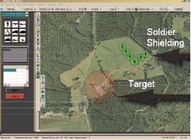 friendly forces positions, or assets requiring protection
 - If the shield and target meet, an alarm will be given automatically.
- Reduces “Blue on Blue” casualties
Planning
Command
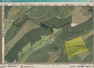
- Electronic sharing of plans.
- A picture saves a thousand words.
- Enables plan updates to be transmitted graphically to deployed units, thereby avoiding misinterpretation.
- Enables in-situ, real time re-planning via a graphic display.
- Submit recordable orders to subordinates, commanders or transmit battle overlays to higher command.
- Lay off Rapid Fire Missions.
“… The system provides an excellent tool for planning. The high quality and accurate Air Photography combined with easy to use software allowed instructors to plan in far greater detail. This was a huge asset when the system was issued at Section or
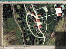 Platoon level” British military
- Electronically pre-plan operations
- Draw control measures e.g.
- Boundaries
- Waypoints
- Report Lines
- Objectives
- Limits of Exploitation
- All military personnel, vehicles, tanks, APl’s, aircraft, and ships can be displayed with their own unique call sign and coloured symbol
- Positional accuracy of the incoming signal depends on the terrain. Once the radios have been operating in the open for over 30 minutes the accuracy is typically 1metre.
 Up to 100,000 units can be registered on the TMPCCS C4i system
- TMP-CCS mapping is highly advanced. Most types of maps can be placed in the system.
- Where no mapping is available, the capture facility can grab satellite images from a variety of internet sites. These images automatically generate their own geo referencing and display images in their correct position.
- Uses a wide variety of geo referenced layeredmapping e.g
- Vector
- Raster
- Aerial Photographs
- Satellite Imagery
 Displays both grid reference and latitude and longitude
Plan Adaption
-
Blue Force monitoring
-
Red Force identifi cation
-
Commanders on the ground can adapt the plan quickly and easily to the fast moving ever-changing battlefield
-
Capture screen shots showing known enemy locations as the intelligence is received and, download to sub units
-
Call up pre-programmed plans instantly
 Tracking
- Reporting Mechanism
-
Operatives can be tracked either periodically, on movement, or on request
-
Position requests can be sent individually or broadcast to a group.
-
TMP-CCS C4i - Logs all positional data and commands for post operational analysis and gathering of evidence.
-
Reported Information Displayed on Map
-
Position reports displayed as configurable icons including;
-
Call sign
-
Weapon ammunition type.
-
TMP-CCS can also be used to play back movements made by individuals or groups, displaying for instance their routes to target.
 “ The ability of patrols to move off without an instructor following is a good option for instructors to have. SCBC relies on the instructor keeping physical contact with his section/patrol during most phases. However,at a higher level of training the system would offer greater benefit.” British military
Training
- Though designed for improved operational effectiveness, TMP-CCS is an ideal training tool.
- Allows the trainer to “stand off” whilst keeping close tabs on students, thereby saving training resources.
- The logging function allows for accurate debriefings.
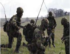 “…The secure radios with GPS provided by TMP-CCS are an excellent system, easy to use and proved to be useful during most phases of the course.”
“The system has a good range from a small hand-held radio.”
“Mapping and Air Photography were extremely accurate.”
“The system allowed for planning and assessment of patrols and gave the instructor the option to stand-off without compromising safety” British military
Interoperability
Communications
It can also operate simultaneously with several different systems. It is possible to track GSM, GPS, GPRS units in addition to UHF VHF radios all at the same time on the same screen.
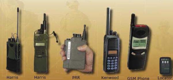
Adding a new user to the TMP-CCS system takes less than 1 minute. Some of the radios currently using the TMP-CCS C4i system include;
“… The equipment was easy to use and maintenance is very low level. The system is robust and there was only one replacement part over the period of the 8 week trial.”
- Lost radios can be stunned but still traced.
- Captured radios can be permanently “killed.”
- Radio comes with integrated GPS.
Communications Management
-
The range of TMP-CCS is limited only by the range of the radios used.
-
The most robust radio will give up to 5 kms range in open terrain

-
A booster or rebro unit may be added. Each can extend the range by 50 to up to 100miles, depending on terrain.
-
“Stun” button to temporarily disable radio if lost and a “kill” button if the radio is captured by the enemy.
-
Vehicle radios can achieve a range of up to 15kms.
-
Data transfer can be encrypted.
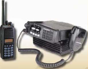 “..The man portable system had a slightly reduced range compared to the vehicle system but would normally work out to 5km. The vest that was supplied for the Instructor to carry the lap top allowed him the option of moving with the Patrol.” British Army
XML or SQL Interface
Positional updates are triggered every 2 seconds.
-
Modular design
-
Parallel communications
-
Information is timely, relevant and shared.
-
 Sharing intelligence helps to confi rm its accuracy.
 -
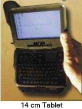
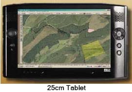
The soldier carries his normal radio (data enabled) while the platoon commander or his signaler carries and operates the system from a PDA, tablet or fieldlaptop computer.
- TMP-CCS will integrate with most available hardware.
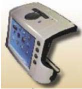
- Compact ruggedized hand held devices.
- Clear and concise information.
- STATIC LOCATION
- In a vehicle, ship, UAV, or at HQ
- MAN PORTABLE
- PDA
- Tablet
- Laptop
- Head-up display
-
Multi Lingual - At the press of a button language can be configured by the user allowing for most modern languages to be displayed.
  |
 |
 |
 |
Special Features
Man Down
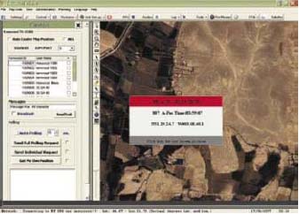
The flag displays ‘Call- Sign’ ‘Blood Group’ ‘Position’ in the event that the soldier is incapacitated his last known position can be shown from the ‘Log.’ This feature greatly increases the soldier survivability.
Low on Ammunition
 |
Lost Radio
 |
KISS – Keep It Simple - Stupid
- TMP-CCS has been designed to be easy and intuitive to use.
-
During trials with the British Army, users were deliberately provided with just 3 hours training. Not with standing this they successfuly operated the TMP-CCS system for 8 weeks with only 1 query.
- A full on-screen HELP fi le supports every feature and explains its operation in simple detail.
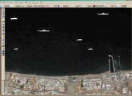
- TMP-CCS is ideal for offshore Maritime operations, locating the exact position of craft up to 7kms from land.
- Ideal for oil rigs security.
- Ideal for night time beach assaults
- Range can be boosted by rebro stations to over 10 miles across water.
Voice Interoperability
- Voice activated control of the TMP-CCS system.
Solar Panels
- Trickle charge
- Reduced weight
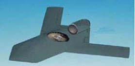
- Programmable to launch, fly to target and hover or drift under autopilot control
- Transmit still images or streaming video
- UAV control fully embedded within TMP-CCS
- XML based generic interface sharing plans and reported locations, to medium and higher C4i infrastructure.
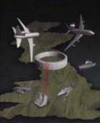
- The integration of ground and perimeter sensors to assist in static defence.
 Weapon sight integration |
 Unknown enemy |
 |
 A real force multiplier! |


